

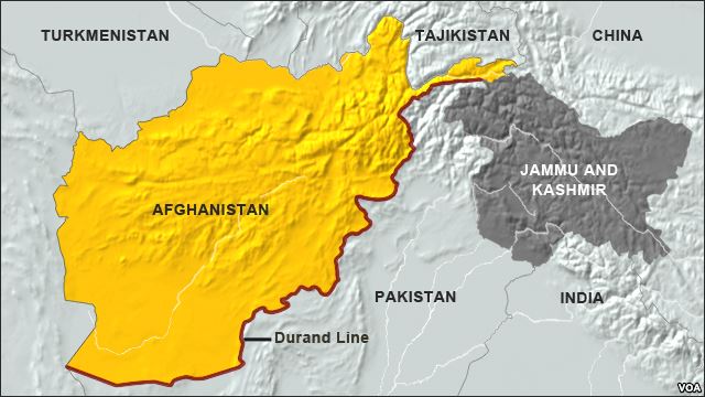
Durand Line
AFP: Pakistan and Afghanistan plan to use Google Maps to help settle a border dispute that led to deadly clashes last week, officials from both sides said Monday. Pakistan inherited its 2,400-kilometre (1,500-mile) border with its western neighbour when it gained independence from Britain in 1947, but Afghanistan has never formally recognised it. And while official Afghan maps reflect the so-called “Durand Line”, many nationalists believe the true border of their country ends at the River Indus that runs though Pakistan and gave India its name. “Officials from the geological survey departments of the two countries will conduct a survey, and they will also make use of Google Maps,” said a senior Pakistani security source in Islamabad who requested anonymity. Click here to read more (external link).